Receiving images from a satellite
This past week, we’ve been waiting for the satellite to pass over the east coast on a day that wasn’t cloudy or rainy — we finally got a window this past Tuesday. We took the antenna out behind Marcus, and in the span of a few minutes, received a ton of pictures of the eastern U.S. from the satellite.

Imaging from the Meteor M2-4 satellite
Being in sun-synchronous orbit, the satellite passes over the roughly same location twice a day, at the same times. For the eastern seaboard, there is a pass in the middle of the night, and around 2:00PM to 4:00PM. Every day, the location where the satellite passes changes slightly due to its orbit, so overhead passes can be hard to come by.
To track the satellite and predict passes with a high overhead elevation, I used n2yo.com — a website that tracks many popular amateur radio satellites, and provides pass predictions as well as other useful data.

10-day predictions for Meteor M2-4
We can use this information to predict when we’ll be able to receive data from the satellite - most importantly, the elevation field should be as close to 90 degrees as possible so that there’s a direct line of sight from the ground.
After building, tuning, and reworking the dipole antenna I made for this project, it ended up looking finally like this —

Dipole antenna build
I’m hoping to make a QFH that’ll perform better for an automated setup moving forward, but for now, this works perfectly fine.
After setting the antenna up outside, and hooking it up to an SDR, I set up SatDump to record I/Q data from the satellite and immediately start decoding it as soon as the signal was strong enough. Soon after we started recording in SatDump, the signal started to show up —

Live decoding view in SatDump
We can see the signal as a bump on the FFT view, and the four ‘circles’ are the decoded OQPSK data.
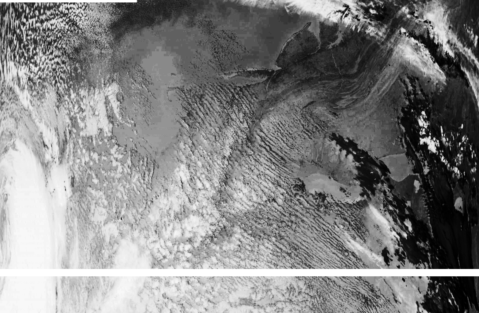
Once the signal died down and the satellite passed, we stopped the recording and waited for the software to finish processing. Once it was done, SatDump gave a raw data file, as well as a ton of pictures including raw images, IR imagery, as well as mapped out images with borders filtered onto the picture.

Bordered
IR

Visible
Moving forward, I’ll be adding an LNA and a filter to the antenna to improve the long term stability of the setup. Then, with a QFH antenna, I can mount it and hook it up to a Raspberry Pi that will automatically capture and send data from every pass that is close enough to detect.